Reading a Valley from Its Contour Lines
Reading a valley from its contour lines helps you identify the drainage, compare slopes, and anticipate narrow passages before you set out.
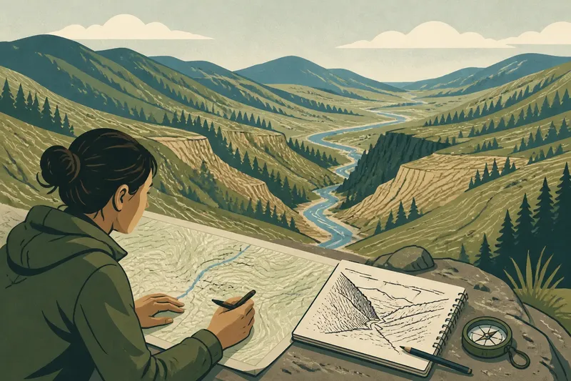
Reading a valley from its contour lines starts with the drainage: repeated bends in the lines show where watercourses run, while their spacing reveals how sharply the valley sides rise. On a paper topographic map, those patterns help you sketch the floor, slopes, and side ravines before you reach the terrain.
Read the elevation clues before tracing the valley
Contour lines connect points at the same elevation. The contour interval, printed in the map margin or legend, states the elevation difference between neighboring lines. Check it before interpreting the spacing, since the interval gives each gap its vertical meaning.
Use labeled contours as anchors. These index contours are often darker or marked with elevation numbers; follow one, then count the intervening lines to understand how the land rises or falls. Keep the map’s units consistent: read feet as feet or meters as meters.
Say Mara has a map with a twenty-foot contour interval. A labeled contour near the valley rim reads 1,200 feet, and lower lines lead toward a creek. She counts the contours between the rim and drainage and sketches a descending valley side, rather than treating every line as a separate landmark.
Follow repeated V shapes to trace the drainage
Where contours cross a stream valley, they bend into V shapes. The point of each V generally faces uphill, toward higher ground; the open end faces downhill along the drainage. This pattern can help you trace an unlabeled creek.
Follow several bends instead of relying on one. If their points face toward the same higher area, they likely mark one valley branch. If another sequence joins or the pattern turns, a side ravine may feed into the main valley.
On Mara’s map, the creek is labeled near the valley mouth but not farther uphill. She follows the repeated Vs to sketch its upper course, while recognizing that contours show land shape, not the water’s current flow or condition.
Compare contour spacing on both valley walls
Closely spaced contours indicate a steeper slope; wider spacing indicates a gentler one. A shift from tight to broad spacing marks a change in slope, perhaps from a steep wall to a softer bench.
Compare both sides rather than assuming they match. Tight, even lines on one wall suggest a consistently steep face; wider gaps or a bulging contour pattern on the other may point to a gentler shoulder or spur. The lines are like slices from a layered cake: their changing outlines reveal the shape between them.
Mara sees tight spacing on the north side and wider gaps on the south. She sketches a sharper rise north of the creek and a less abrupt climb to the south, without assuming that either surface is smooth. Vegetation, rock, and small cuts may add detail the map does not show.
Look for constrictions, openings, and side valleys
When contours on opposite sides draw close near the drainage, the valley may narrow into a confined passage. When they bow outward and leave more room between the sides, the floor may open into a broader basin or a gentler stretch.
A rounded projection of contours extending from a ridge can mark a spur descending toward the valley. A hollow between spurs may form a side valley, often visible as another set of uphill-pointing Vs. These shapes help explain why a mapped trail might bend around a slope.
In Mara’s map, two spur shapes approach the creek and pinch the valley. She marks a likely narrow passage, then sees the contours spread apart beyond it and sketches a wider floor. Her reading distinguishes a confined section from the broader stretch that follows.
Check symbols and elevation before naming a landform
Confirm the contour interval, locate labeled elevations, and use the legend to distinguish contours from streams, trails, roads, and boundaries. Closely spaced lines signal a steep slope, but they do not by themselves identify a vertical cliff or describe ground conditions.
Closed contours need an elevation clue. Values that rise toward the center suggest a hill; short inward ticks, called hachures, indicate a depression on maps that use them. Consult the legend for the sheet’s conventions, since a closed shape alone does not tell you whether the land rises or sinks.
Mara finds a small closed contour near the rim marked with inward ticks. She reads it as a depression rather than a summit and adds that distinction to her sketch. The legend confirms the symbol’s meaning on her map.
What can valley contour lines tell you?
How can I tell which way a valley runs?
Look for repeated contour Vs where lines cross a drainage. Their points generally face uphill, so the valley runs the opposite way, toward lower ground.
Do close contour lines prove there is a cliff?
No. Close spacing indicates a steep slope, but the map does not establish that the surface is vertical or reveal its condition. Read the legend and consult current local information if the distinction matters for your route.
How can I distinguish a hill from a depression?
Check labeled elevations: values that rise toward the center indicate a hill. Inward-pointing hachures mark a depression on maps that use them, and the legend explains the symbols.
Do wide contour gaps mean the valley floor is flat?
Wide gaps can indicate a gentler slope or a relatively level stretch, particularly where contours spread across the valley bottom. They do not prove the floor is perfectly flat; the map’s scale and contour interval limit the detail shown.
Make a concise sketch from the contour evidence
Mara’s finished sketch notes the creek’s direction, the steeper north wall, the broader south side, the pinch between spurs, and the valley opening beyond. Each note describes a visible pattern and frames it as an expectation, not a promise about conditions on the ground.
For your own map, mark a labeled elevation, trace drainage from repeated V shapes, compare spacing on both walls, and note spurs, constrictions, and closed contours. Reading a valley from its contour lines this way gives you a usable landform picture and helps you identify what to check against the terrain.